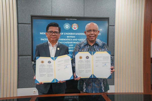
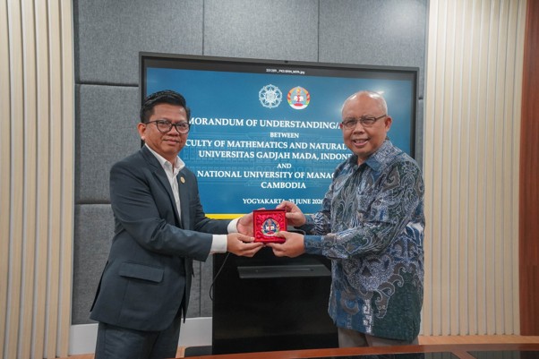
FMIPA UGM dan Management University Kamboja Teken MoU untuk Perkuat Kerja Sama Akademik dan Riset
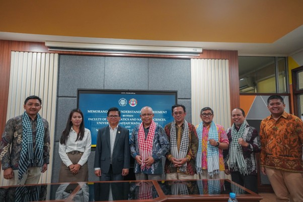
Fakultas Matematika dan Ilmu Pengetahuan Alam (FMIPA) Universitas Gadjah Mada menerima kunjungan delegasi Management University, Kamboja, pada Rabu (25/6). Kunjungan tersebut menjadi bagian dari penandatanganan nota kesepahaman (MoU) yang menandai komitmen kedua institusi dalam memperkuat kemitraan di bidang pendidikan, penelitian, dan pengembangan akademik.
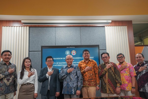
Kegiatan yang berlangsung di Fakultas MIPA UGM ini dihadiri oleh Dekan FMIPA UGM, Prof. Dr.Eng. Kuwat Triyana, M.Si., Wakil Dekan Bidang Alumni, Kerjasama, dan Inovasi, Prof. Fajar Adi Kusumo, Daniel Oscar Baskoro selaku ketua Kamipagama, serta perwakilan dari sejumlah departemen di FMIPA UGM, yakni Danang Teguh Qoyyimi, S.Si., M.Sc., Ph.D. dari Departemen Matematika, Prof. Dr.rer.nat Nurul Hidayat Aprilita, S.Si., M.Si. dari Departemen Kimia, dan Dr. rer. nat. Herlan Darmawan, M.Sc. dari Departemen Fisika.
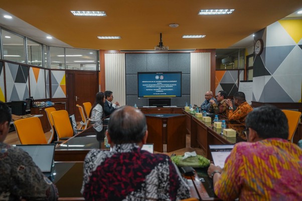
Dalam kesempatan tersebut, masing-masing departemen memperkenalkan bidang keunggulan, fokus pendidikan, serta aktivitas penelitian yang dikembangkan di FMIPA UGM. Paparan tersebut memberikan gambaran mengenai kapasitas dan potensi yang dimiliki FMIPA UGM untuk mendukung berbagai program kemitraan internasional.
Ketua Departemen Matematika, Danang Teguh Qoyyimi, S.Si., M.Sc., Ph.D., turut memaparkan sejumlah bidang kepakaran yang dikembangkan di Departemen Matematika, termasuk matematika finansial, asuransi, dan manajemen risiko. Berbagai bidang tersebut dinilai memiliki relevansi yang kuat dalam mendukung pengambilan keputusan berbasis data, pengelolaan risiko, serta pengembangan sektor keuangan dan layanan publik.
“Selain memperkuat aspek teoretis, kami juga mengembangkan berbagai bidang terapan yang relevan dengan kebutuhan masyarakat dan dunia industri. Dalam pengembangan tersebut, kami menjalin kolaborasi dengan berbagai fakultas di UGM, termasuk Fakultas Ekonomika dan Bisnis serta Fakultas Hukum. Pendekatan multidisiplin ini membuka banyak peluang untuk membangun kerja sama yang lebih luas dengan berbagai mitra, baik di tingkat nasional maupun internasional,” jelas Danang.
Dalam sesi diskusi, kedua institusi turut membahas berbagai peluang yang dapat dikembangkan pada masa mendatang, mulai dari penelitian bersama, pertukaran akademik, hingga penyelenggaraan program pendidikan. Berbagai bidang yang memiliki irisan dengan fokus keilmuan Management University turut menjadi bagian dari pembahasan sebagai potensi pengembangan program bersama di masa depan.
Delegasi Management University menyambut baik berbagai peluang tersebut dan berharap kemitraan yang terjalin dapat memberikan manfaat bagi kedua institusi. Melalui penandatanganan MoU ini, FMIPA UGM dan Management University Kamboja diharapkan dapat memperluas jejaring internasional serta mendorong lahirnya berbagai inovasi yang memberikan dampak positif bagi masyarakat global.
Kegiatan ini turut mendukung pencapaian Sustainable Development Goals (SDGs), khususnya SDG 4 (Pendidikan Berkualitas) melalui penguatan kerja sama akademik dan pertukaran pengetahuan antarperguruan tinggi lintas negara. Selain itu, kolaborasi dalam bidang penelitian dan pengembangan inovasi berkontribusi pada SDG 9 (Industri, Inovasi, dan Infrastruktur) dengan mendorong terciptanya riset yang relevan terhadap tantangan global. Kemitraan antara FMIPA UGM dan Management University Kamboja juga mencerminkan implementasi SDG 17 (Kemitraan untuk Mencapai Tujuan) melalui pembangunan jejaring internasional yang mendukung pengembangan pendidikan tinggi, penelitian, dan kapasitas sumber daya manusia secara berkelanjutan.

Penulis: Inna Mutifah
Fotografer: Afiandina Sukma